


On Dec. 6, Fayetteville Regional Airport (FAY) was awarded $5,000 from the North Carolina Department of Transportation Division of Aviation to host their annual Aviation Career Education (ACE) Academy.
The ACE Academy is a free two-day program hosted by FAY for middle and high school students interested in the field of aviation. During this program, students are able to learn about the many facets of aviation from the air traffic control tower to Civil Air Patrol and military aviation to piloting.
This summer educational program helps increase awareness for careers in the aviation space, and specifically piloting, as we see the pilot shortage continuing to affect airlines.
“It truly is an incredible opportunity to be a part of students experiencing the field of aviation first- hand,” said Airport Director Andrew LaGala in a press release. “We are able to share potential career paths with them and hope to see them as the next generation of pilots, mechanics, and ATC controllers.”
Last year, students were able discover the wonder of flight as they embarked on discovery flights with Cape Fear Aviation and Raleigh Professional Flight School, learn the inner operational workings of FAY, and learn from professionals in the field of aviation.
Applications for 6th through 12th grade students are expected to open in May 2025. FAY is scheduled to host this year’s ACE Academy on Aug. 4-5.


A family affair: Along with a full staff, Owner Eddie Claude and his wife Ruth (pictured right) work with their kids to run the restaurant. Eddie is a Veteran who served for 21 years in the U.S. Army. Photos by YGH STUDIOS & GFBJ. The Fayett
With summer in full swing, I started to reflect on the various ways I spent my summer break over the years. From pool parties with friends to family vacations and sports tournaments, I look back fondly on the summers I’ve enjoyed so far. But it
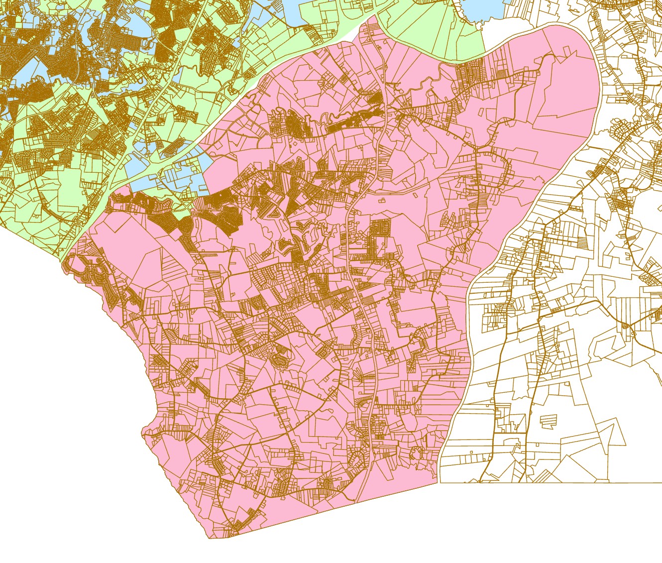
Proposed incorporation boundary (pink) · Gray’s Creek, Cumberland County, N.C. This is a working draft and is subject to revision. Image courtesy of grayscreeknc.com. After decades as an unincorporated rural community in Cumberland County, Gray’