

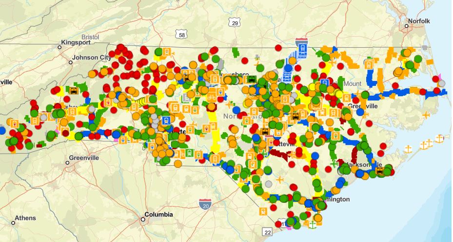
A draft of the state’s next long-range transportation improvements plan is now available for public review.
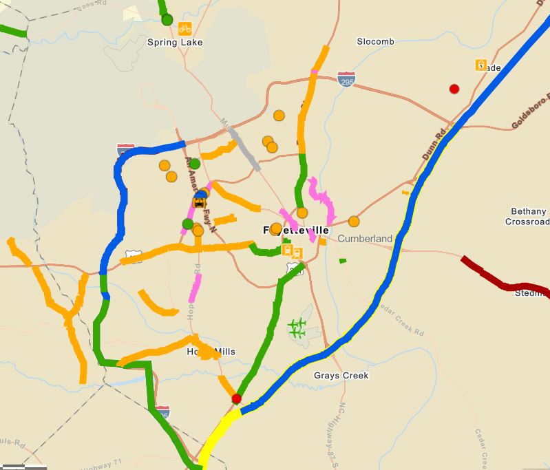
The State Transportation Improvement Program, or STIP, is the N.C. Department of Transportation’s guide that shows how and when transportation projects are expected to be funded over the next 10 years. Projects scheduled in the first five years are generally considered to be scheduled for delivery, while those on the latter half of the schedule are funded for preliminary engineering only and are subject to be re-evaluated when the next STIP is developed.
A public comment period for the draft STIP for years 2026-2035 is now open and runs through April 4. People can review the document and submit feedback online by visiting www.ncdot.gov. Local NCDOT offices across the state will also hold weeklong drop-in periods in the coming months for the public to ask questions and submit comments in person. More information on the times and locations of those meetings will be posted at www.ncdot.gov once schedules are finalized.
NCDOT typically updates the STIP every two years. The department uses data and local input to determine which projects get funded in the 10-year plan based on a specific formula created by the Strategic Transportation Investments law. This allows NCDOT to use its funding more efficiently to enhance North Carolina’s infrastructure, supporting economic growth, job creation and a higher quality of life.
Transportation officials are expected to adopt the 2026-2035 STIP in summer 2025.
More information on the STIP process can be found on the NCDOT webpage.


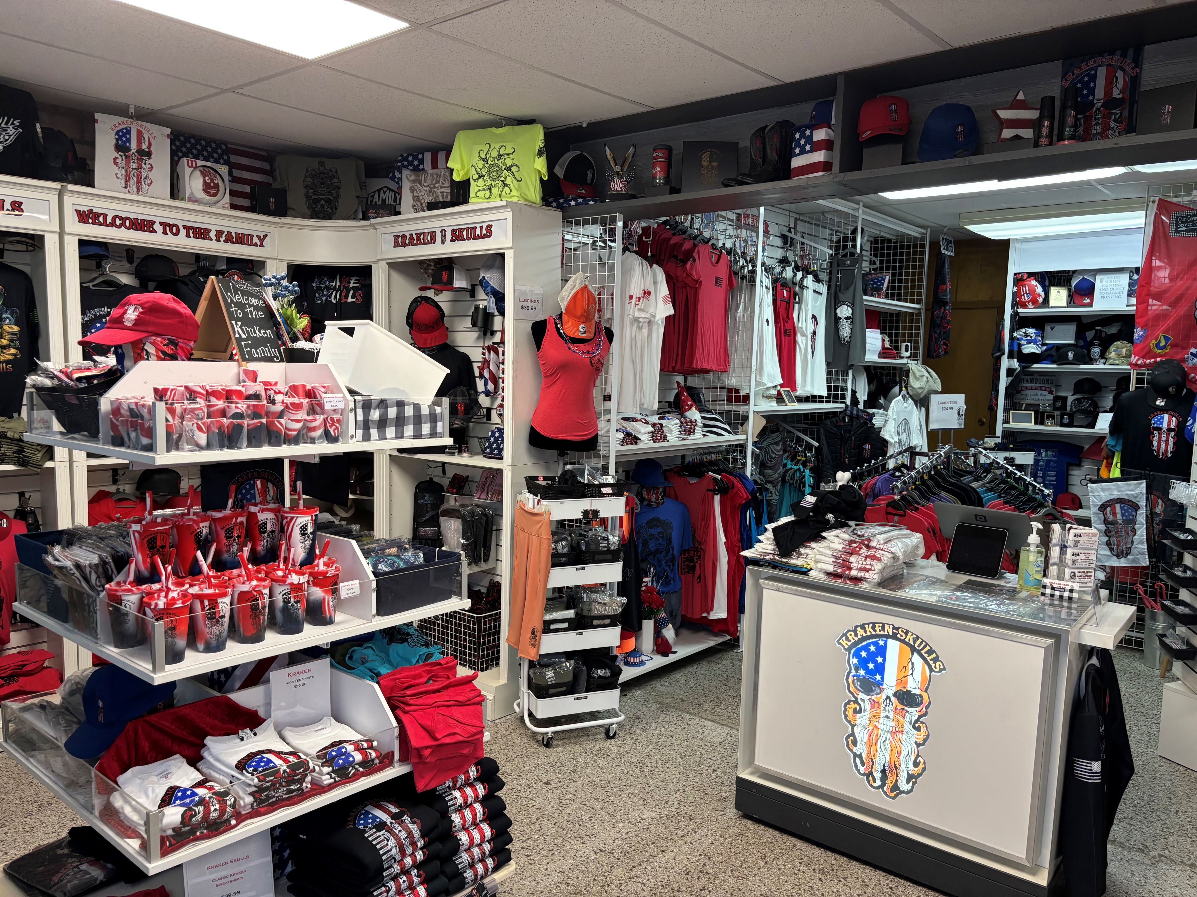
The KRAKEN-SKULLS brand includes a barbershop, a tattoo shop, a T-shirt company, an embroidery company, a website design company, a media marketing and graphic design company and an auto shop. Photos by GFBJ.When Chad Kraken retired from the military
Fred Surgeon, with the support of his wife Anita, owns and operates Surgeon &Associates, Inc, a family of businesses with everything from agritourism, pestcontrol, cleaning services and behavioral health services. Photos provided by Fred Surgeon.

Agents and leadership from Coldwell Banker Advantage and Coldwell Banker Sea Coast Advantage gathered to celebrate one of their own as she was recognized with two national achievements. A new C-Suite leader was also in attendance.